01

Burstall Pass | 2010-12-05

Burstall Pass II
  • Location: Kananaskis Country (Highway 742)
  • Activity: Ski Touring
  • Height: 2,350 m (7,710 ft)
  • Elevation Gain: 700 m (2,297 ft)
  • Distance: 16.7 km / Round Trip (10.4 mi)
  • Avg Steepness: 4.8°
  • Estimated Time: 5-7 hrs
  • Technicality: Intermediate
  • Fitness Level: Moderate

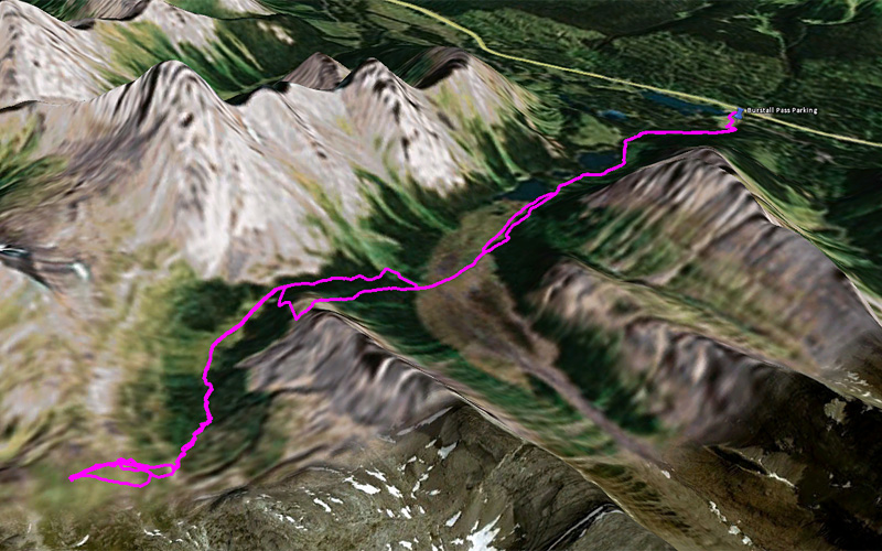
Note: GPS track is from Burstall Pass Peak not from this trip.

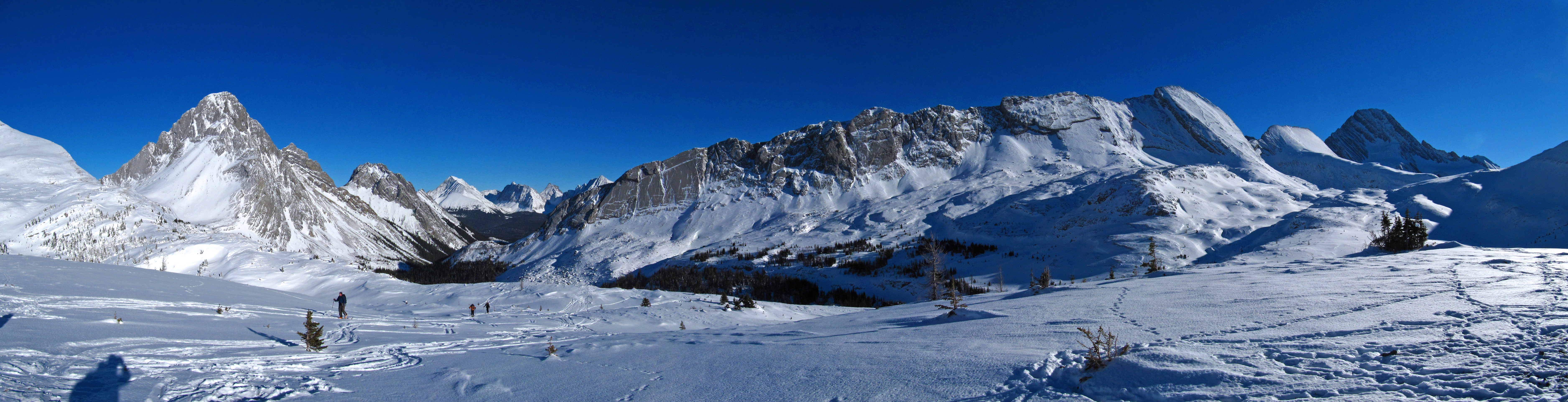
I was invited to Ben’s ski trip to Burstall Pass on Sunday. The weather was just like the previous day, blue sky without a single cloud, BUT but butt? what? …COLD!! Burstall Pass being so popular and having such a definitive trail, I don’t think I need to write route description here… nice!! According to experienced, snow depth wasn’t quite deep enough yet. Yes my skis got few scratches. And more to come, unfortunately for my skis…

02

Burstall Pass | 2010-12-05

At the parking lot. Preparing for a great day!

03

Burstall Pass | 2010-12-05

This thermometer is not made for Canadian standard. Also this -30 or below temperature is too warm. Rubbish must try harder!

04

Burstall Pass | 2010-12-05

3 peaks and 1 ridge from flat. Mouseover for names.

05

Burstall Pass | 2010-12-05

Whistling Rock Ridge.

06

Burstall Pass | 2010-12-05

Burstall Pass in winter.

07

Burstall Pass | 2010-12-05

This is where we skied for few runs.

08

Burstall Pass | 2010-12-05

Mount Sir Douglas. I love this place both in summer and winter.

09

Burstall Pass | 2010-12-05

Burstall Pass Peak below the sun.

10

Burstall Pass | 2010-12-05

More peeps coming up. I am not used to go where so many people go… Mouseover for names.

11

Burstall Pass | 2010-12-05

Hahahahahaha. Heather going down!!

12

Burstall Pass | 2010-12-05

Ben going for a jump.

RETURN TO TOP
 
CLICK BLANK SPACE OR PRESS ESCAPE TO EXIT